FOR IMMEDIATE RELEASE: 12
October 31, 2012
Contact:
Chris Gilbride/Ted Timbers (DEP) (718) 595-6600 Chanel Caraway (DOHMH) (347) 396-4177
Recreational Water Advisory For Hudson River, East River, New York Harbor, Jamaica Bay and Kill Van Kull
Due to flooding and power related shutdowns caused by Hurricane Sandy, wastewater treatment plants and pumping stations have discharged untreated wastewater into New York City waterways. The New York City Department of Health & Mental Hygiene advises that direct contact with the Hudson River, East River, New York Harbor, Jamaica Bay and the Kill Van Kull for recreational activities such as swimming, canoeing, kayaking, windsurfing or any other water activity that would entail possible direct contact with the water should be avoided until further notice.
The Department of Environmental Protection is responding to the impacts caused by Hurricane Sandy on its waste water treatment facilities and will monitor water quality conditions through testing to verify when these water bodies are safe for recreational uses.
Showing posts with label jamaica bay. Show all posts
Showing posts with label jamaica bay. Show all posts
Oct 31, 2012
Aug 22, 2011
Plane Zones
Plane zone, Saturday:
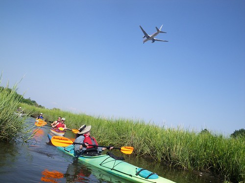
Plane zone, Sunday:
Noon to two,
woo hoo hoo!
Holly the Sailing Co-Chair's post-sail comment - "Anyone who didn't plane today is doing something wrong".
What a splendid Sebago weekend it was!
Plane zone, Sunday:
Noon to two,
woo hoo hoo!
Holly the Sailing Co-Chair's post-sail comment - "Anyone who didn't plane today is doing something wrong".
What a splendid Sebago weekend it was!
Mar 31, 2011
J-Bay Task Force Meeting - JFK AIRPORT EXPANSION RESPONSE!
"Reclamation", the powers that be are calling the proposal to turn some number of acres of Jamaica Bay into airport runways...
Here's a meeting that should be of great interest to those who love Jamaica Bay. I highly doubt that I will be able to make it because of work pressures, but I did want to spread the word.
JAMAICA BAY TASK FORCE MEETING
APRIL 7, 2011 @ 6:30 pm
NPS Jamaica Bay Wildlife Refuge Visitor Center
Cross Bay Blvd. Broad Channel, NY 11693
AGENDA
6:30 - 6:45 Sign in, Introductions, Acknowledgment of Elected/Agency
Officials
6:45 - 7:05 Overview of Regional Plan Association Proposed Plan for
Expansion of JFK Airport- Environmental Response
Dan Mundy Jr. Jamaica Bay Ecowatchers
7:05 - 7:15 Potential impacts of JFK Expansion
Brad Sewell, Senior Attorney, Natural Resources Defense
Council
7:15 - 7:35 JFK Airport Expansion and Bird Hazard issues
Don Riepe, Jamaica Bay Guardian
7:35 - 7:55 Marine Life in the targeted areas; A
commercial/recreational
Perspective from the local Fishing Industry
Captain Vincent Calabro
7:55- 8:30 Discussion, Q & A
Dan Mundy, Don Riepe
Co-Chairs
For more information and directions, please call 718-318-9344
Mar 21, 2011
Last Paddle of Winter + Paerdegat Proxigean Promenade

If everybody didn't know I was probably at the beach, I would call this picture "Tea in the Sahara".
It's one of a very few I took on my last winter paddle (to Breezy Point, that's Minh & TQ in the picture above) - first off, the weather was extremely breezy & I had to concentrate on paddling, and secondly, I was out of reach of my charger for the weekend & wanted to save the batteries for the very unusual and fun event that some very smart folks at Sebago had put together in honor of the midafternoon arrival of the Supermoon Proxigean Low Water - a shorewalk right in our own Paerdegat Basin!
It was GREAT - thanks to all who helped organize, I really enjoyed seeing our familiar basin from a different point of view.
More pictures from both days (but mostly the shorewalk) can be found here.
Oct 12, 2010
Columbus Plus Nine
 |
| Group photo while beached on Ruffle Bar. Photo by Gary. |
For a fuller and only slightly biased and embellished trip report, read the post at Summit to Shore.
Jan 30, 2010
Icy Paddle
 |
| From Proxigean Paddle! |
The proxigean high wasn't the bank-buster it was last year - apparently this time it was the 1 a.m. low that was the big deal (to the point that there had been a warning about it in the marine forecast). But we were already at the club, and breakfast was delicious, and we had a good icy paddle with a toasty woodstove, sandwich fixings and homemade soup & applesauce waiting at the clubhouse when we finished (the food was a nice surprise, I only thought we were getting breakfast).
And the photo is of my spare paddle, a Greenland paddle I carry on my front deck at all times except when I'm using it (at which point the Euroblade becomes the spare). It became a very icy paddle on our icy paddle!
Full photo trip report at the link above.
Thanks to all the clubmates who instigated & made it happen!
cross-posted at Frogma
PS - I'm actually posting this after John's but I like his report so I'm changing the time on this so his stays on top.
Oct 13, 2009
Columbus Day Paddle
Why Should Columbus get all the credit?

In 1492
Columbus sailed the ocean blue.
517 years to the day
Sebago kayaked Jamaica Bay
Eighteen paddlers, 6.9 miles, 3 ½ hours. Read all about the Columbus Day Paddle at summit to shore. A link to photos from the trip is at the end of the post.

In 1492
Columbus sailed the ocean blue.
517 years to the day
Sebago kayaked Jamaica Bay
Eighteen paddlers, 6.9 miles, 3 ½ hours. Read all about the Columbus Day Paddle at summit to shore. A link to photos from the trip is at the end of the post.
Oct 7, 2009
Early Morning Early October Paddle
 Tony, Michael, John W. and John H. enjoyed an early morning paddle Tuesday, Octoober 6, 2009, under almost perfect conditions. Water in Jamaica Bay was around 62. Air temperature at put in was near 60 but warmed to the high 60's by trip's end. There was little wind and the water seemed unusually clear. Paddling east into Spring Creek and Hendricks Creek, they paddled 11.8 miles, averaging 3 mph over the trip. A fuller trip report, with a link to more photos, is available at Summit to Shore.
Sep 29, 2009
Birthday Paddle
 Led by Tony, five early morning paddlers including two Johns and two Michaels, left Sebago Tuesday morning around 8:00 AM, paddled through the wind past the Marine Parkway Bridge, and were back at the dock by 12:15 PM, a 9.2 mile paddle. By the way, it was Tony's birthday! Since he intends to do some sanding of his boat, Micahel prepared birthday party hats made of particle masks (photo right). I have posted a fuller trip report about this early morning paddle, with a link to more photos, on my blog.
Aug 7, 2009
08/02/09 Jamaica Bay Circumnavigation
 Bonnie (pictured right) and I enjoyed an excellent long distance paddle last Sunday, August 2, 2009 after both of us had crappy weeks and after the storm passed over Jamaica Bay. It was my second longest paddle ever, longest this season, and the best trip Bonnie ever cancelled. We have both written about our five and a half hour circumnavigation of Jamaica Bay on our respective blogs. Photos accompany both posts. Read out posts and see our photos by clicking on the hot links above.
Jul 19, 2009
Jamaica Bay Sundy
Vicki and I had intended to paddle our sit-on-tops to The Raunt where we planned to enjoy a picnic lunch but after paddling for two hours into a strong wind opted to beach on Ruffle Bar instead. As we approached closer to Ruffle Bar we saw a couple other kayakers that ended up also being from Sebago. Meanwhile Sebago sailors were tacking to and fro in the strong breeze.
We beached, dragged our boats up on the shore of Ruffle Bar, and ate the lunch we had intended to eat on the Raunt. Our Subway subs and Cherry Cokes tasted better out of the wind and under the sun than they would have ever tsted in the restaurant. As the tide came in and lapped against our boats we packed up and headed back to Sebago. With the wind at our backs and surfing a few waves our return trip seemed to take half as long and was twice as enjoyable as our paddle out had been frustrating.
Back at Sebago, as we were taking our boats up to the wash racks, we met Bonnie. She had returned just ten minutes earlier from her paddle all the way from Governor’s Island. We congratulated her on the accomplishment and then rinsed our boats, packed up our gear, and headed home.
All in all it was a good afternoon on Jamaica Bay. The water was warm. The sky was blue with a few high clouds. Power boat traffic w as minimal.
We beached, dragged our boats up on the shore of Ruffle Bar, and ate the lunch we had intended to eat on the Raunt. Our Subway subs and Cherry Cokes tasted better out of the wind and under the sun than they would have ever tsted in the restaurant. As the tide came in and lapped against our boats we packed up and headed back to Sebago. With the wind at our backs and surfing a few waves our return trip seemed to take half as long and was twice as enjoyable as our paddle out had been frustrating.
Back at Sebago, as we were taking our boats up to the wash racks, we met Bonnie. She had returned just ten minutes earlier from her paddle all the way from Governor’s Island. We congratulated her on the accomplishment and then rinsed our boats, packed up our gear, and headed home.
All in all it was a good afternoon on Jamaica Bay. The water was warm. The sky was blue with a few high clouds. Power boat traffic w
 as minimal.
May 24, 2009
Conditions in Jamaica Bay
 I paddled in Jamaica Bay with Tony and Walter Friday morning, May 22, 2009. It was my first time back in the Bay since October. Water temperature at the dock was 65°F. In the Bay proper it ranged from 58°F to 61°F. The low tide water levels were some of the lowest Walter, Tony or I have ever seen in the Bay. Upon return from a trip the following day, Phil volunteered that the low tide water levels were also some of the lowest he had ever seen, which perhaps explains why a power boat had run aground and was stranded on a sand bar under the Belt Parkway bridge Friday (photo at right).
A fuller account of Friday's trip has been posted on my blog.
May 13, 2009
Boaters Rescued in Windswept Jamaica Bay
 Fellow Sebago Canoe Club member and NOLS alum John Huntington distributed this link to a story about a rescue of boaters in windswept Jamaica Bay. There is also a follow up link to a story in the New York Post. The boaters were in a fishing boat, not a kayak. Nevertheless I think there is a lesson to be learned here.
I have paddled in Jamaica Bay when the there has been hardly any wind and the water was like glass. Likewise I have been out kayaking in the Bay when there was a strong enough wind over enough fetch to create white caps and standing waves over shallow shoals. The danger lies in calm condition luring inexperienced boaters out into the open bay far from shore only for the weather to drastically change for the worse with little if any warning, catching the boaters unprepared. This is why it is wise to know how to assist in one's own rescue as well as to assist others in being rescued and to practice such rescues (pictured top right) before they are necessary.
With six or seven years of paddling under my PFD, Jamaica Bay does not intimidate or scare me, but I still respect it because it demands respect. Becoming familair with rescue techniques is one way of showing that respect.
Jul 24, 2008
New Water Quality Testing Program Calls For More Information to Guide Safe Recreation (click here for full report)

On July 24, Riverkeeper launched its Swimmable River Campaign and unveiled its Water Quality Testing Program being done in partnership with Columbia University's Lamont-Doherty Earth Observatory aboard the Riverkeeper patrol boat. The program aims to investigate the processes that control Hudson River water quality, begin to provide water quality data to the public, and inform the government�s water quality management decisions with sound science. It is the first program to regularly test Hudson River water quality from New York Harbor to Albany and make the data publicly available quickly.
For Immediate Release: July 24, 2008
Contact: Renee Cho, Riverkeeper
914-478-4501 x 239
rcho@riverkeeper.org
This is a clickable map....
find your area for water quality results:

The initial findings also highlight a number of concerns:
• There are specific locations (i.e. Piermont Pier in Piermont and Newtown Creek in Brooklyn) that have chronically poor water quality conditions;
• Severe wet weather conditions, even if short-term, can render much of the estuary unsafe for activities such as swimming and kayaking.
• There are times and places, particularly near-shore after wet weather events, where counts of sewageindicating bacteria far exceed federal and state standards for primary contact recreation;
• In 2007, 21 percent of samples collected north of New York City had counts of sewage-indicating bacteria that exceeded the federal single sample guideline for primary contact;
• In the waterways surrounding New York City, 32 percent of the samples exceeded the federal single sample guidelines for primary contact;
Riverkeeper specifically recommends that government officials and environmental and public health agencies take the following actions:
Better Policy:
• Renew New York’s pledge for a swimmable Hudson River estuary;
• Create a cohesive water quality protection program for the region;
• Increase protection for key wetlands and buffer zones;
• Classify kayaking and personal watercraft use as primary contact recreation;
• Increase interagency and intra-agency communication;
• Focus testing and notification procedures on extreme conditions, in addition to averages;
• Work towards passage of the Federal Beach Protection Act and the Raw Sewage Overflow Community Right to Know Act; and
• Develop and implement sustainable stormwater management bills.
click on the title for the complete press release!
Aug 20, 2007
Little Place called Jamaica Bay
 Most of the time, the bay is where I kayak and play. I escape the city for solitude. Over time, I have noticed little things like birds and fish. Odd little creatures they are. You get a feeling that you do share space with them by observing their habits. Here is Kemp's ridley sea turtle used to be in the bay.
So, I sat down and learn a bit more about what they are; birds and fish. I am not an expert in this. I came across this US government training material from the National Conservation Center. And here is some pictures of birds commonly found in the bay. I linked many of these species to various pictures and sources notably wiki pages.
"The waters and sediments of Jamaica Bay are a highly productive and regionally significant habitat for finfish, shellfish, and wildlife. Eighty-one species of fish were found to use Jamaica Bay in a survey conducted by the National Park Service in 1985, corroborating other findings. The majority of fish collected were juveniles using the bay as a nursery area. Winter flounder (Pleuronectes americanus) was the most important commercial and recreational fish to use the bay in great numbers during all life stages; the bay is also believed to be a significant breeding area for this species. Forage fish species with high abundances, including Atlantic silverside (Menidia menidia), bay anchovy (Anchoa mitchilli), mummichog (Fundulus heteroclitus), Atlantic menhaden (Brevoortia tyrannus), and striped killifish (Fundulus majalis), form a prey base for other fish and birds that use the area. Some of the other common species found in surveys and recreational landings include scup (Stenotomus chrysops), bluefish (Pomatomus saltatrix), windowpane (Scophthalmus aquosus), tautog (Tautoga onitis), weakfish (Cynoscion regalis), black sea bass (Centropristis striata), summer flounder (Paralichthys dentatus), American eel (Anguilla rostrata), and searobin (Prionotus spp.). Anadromous species that use the area include blueback herring (Alosa aestivalis), Atlantic sturgeon (Acipenser oxyrhynchus), alewife (Alosa pseudoharengus), American shad (Alosa sapidissima), and striped bass (Morone saxatilis)."
 I am a student of biology. I read this list of endangered species in the bay. Here is Roseat Tern as endangered species.
Federally listed endangered
Atlantic (=Kemp's) ridley sea turtle (Lepidochelys kempii)
roseate tern (Sterna dougallii)
peregrine falcon (Falco peregrinus)
Federally listed threatened
loggerhead sea turtle (Caretta caretta)
piping plover (Charadrius melodus)
seabeach amaranth (Amaranthus pumilis)
Federal species of concern(1)
diamondback terrapin (Maclemys t. terrapin)
Roland's sea-blite (Suaeda rolandii) ...........................
"Jamaica Bay has been substantially altered by extensive dredging, filling, and development in and around the bay. ..... the bay receives substantial pollution from a variety of point and nonpoint sources; these include municipal waste water discharge from three plants (320 million gallons per day), combined sewer overflows, untreated storm water runoff from the roads and developed areas around the bay (including the runways at John F. Kennedy Airport which are contaminated with de-icing chemicals), leaching of contaminants from three large closed landfills (Edgemere, Fountain Avenue, and Pennsylvania Avenue landfills), atmospheric pollution, especially soot and toxic chemicals from transportation, and windblown trash; there is the added potential risk of spills due to substantial water transportation of oil and chemical products in the bay. Nutrient and high oxygen-demanding organic matter inputs result in phytoplankton blooms, low levels of light transmission, and low bottom dissolved oxygen concentrations. Present and historic inputs of toxics, including hydrocarbons (especially polynuclear aromatic hydrocarbons such as napthalene) and heavy metals, have resulted in contaminated sediments ......"
I also came across this DEP Jamaica Bay Proposal online.
"These various habitats support 91 fish species, 325 species of birds and many reptile, amphibian and small mammal species. The Bay is a critical stop for birds along the Eastern Flyway migration route and has become an internationally renowned birding destination. Portions of the Bay, most notably the Jamaica Bay Wildlife Refuge, have been designated as Significant Coastal Fish and Wildlife Habitats by the federal and state governments."
I also came across a document from the Department of Environmental Conservation. What is cool about this paper is that they have satellite pictures of various islands of the bay from 1974 and 1999. This is imaging study using remote sensing techniques. I am not familiar with the techiques but I noticed that red color had dissipated during the time. From my read on wikipedia of satellite imaging, images do not record what eyes can see since they are recorded in spectral analysis including infrared to reveal material and vegetation. On to what is not cool is that they look like the receding glaciers. These pictures give me the same feelings; receding sea.
 I was looking at a picture of a threatened species called seabeach Amanrath. It is 1.3 to 2.3 centimeters and threatened. It lives around the bay's beach.
Seabeach amaranth is an annual plant found on the dunes of Atlantic Ocean beaches. The stems are fleshy and pink-red or reddish, with small rounded leaves that are 1.3 to 2.5 centimeters in diameter. "
See these other colorful neighbors of the bay.

Aug 2, 2007
Jamaica Bay Loses Marshes at Faster Rate, Report Says

American oystercatchers taking flight in the marsh grasses of Jamaica Bay, where marshland is shrinking. They are on the Audubon Society’s watchlist for species facing population loss or threats like loss of habitat.
EW YORK (AP) - The scene from Dan Mundy's living room window is worlds away from the normal urban views of New York City.
The sky is a brilliant blue, and the waters lapping at the stone wall just a few feet away are clear and calm. A duck paddles off, and even a jellyfish looks more peaceful than dangerous as it undulates near Mundy's dock.
Welcome to Jamaica Bay, a wildlife haven just next door to John F. Kennedy International Airport, reachable by subway from Manhattan's skyscrapers some 15 miles away.
The tranquility hides a truth well-known to Mundy and others who have spent their lives here - the salt marsh islands dotting Jamaica Bay are disappearing.
The loss of the islands could have huge ramifications for the environment because a quarter of the country's bird population makes its way through Jamaica Bay.
Marsh loss has always been part of life in the bay, but it has been accelerating in the past decade or so, said Mundy, a retired firefighter who advocates for the marshes.
Records show Jamaica Bay averaged a loss of 26 acres a year from the mid-1970s until the mid-1990s, but the pace picked up to more than 40 acres a year by 1999, the last time a comprehensive look was taken, said Brad Sewell of the Natural Resources Defense Council, who serves as co-chairman of an advisory committee for the bay.
Anecdotal evidence indicates the situation has probably gotten worse in the last couple of years.
There are around 1,000 acres of salt marsh islands in the bay. If the disappearance continues at its current rate or accelerates, the islands could be gone in less than 20 years, Sewell said.
No one knows for sure why the marshes are disappearing. Several possibilities are being considered, including the rise in sea level and the lack of sediment to renew the marshes flowing into the bay.
``Research has looked at a handful of contributing factors, none of them have emerged as a clear cause,'' said Steve Zahn, a program manager for a marine resources unit for the state Department of Environmental Conservation.
Some are convinced that excessive nitrogen from the city's four wastewater treatment plants is a factor. The nitrogen - a byproduct from the water treatment process - feeds algae blooms, which die off and are decomposed by bacteria that use a lot of oxygen, leaving less in the system.
The city acknowledges that more nitrogen than the system can handle is being discharged into the bay, but also says there is no definitive scientific evidence that the nitrogen is the main cause of the marsh loss.
The scientific model for water quality doesn't show that making the significant financial investment into reducing the amount of nitrogen coming out of the wastewater treatment plants will significantly raise the dissolved oxygen level, said Angela Licata, deputy commissioner of environmental planning and analysis at the city Department of Environmental Protection.
The water quality model did show an improvement in Long Island Sound, so the city invested in reducing nitrogen output there, she said.
Restoration is one possible way to fix the problem, but restoration projects are expensive.
A couple of marsh islands have been replanted, but the cost needs to come down before more projects are done, said Douglas Adamo, chief of the division of natural resources for Gateway National Recreation Area, of which Jamaica Bay is a part.
Otherwise, ``the cost will be so prohibitive that we're not going to get many acres for the dollar,'' he said.
But the price of a bay without the marsh islands is higher than anyone would want to pay, said Mundy and others.
Mundy pointed out that the islands act as a buffer for waves coming across the bay. Without them, the waves would roll in several feet higher than they already do. ``It's like a disaster waiting to happen here,'' he said.
And the role the marshes play in the ecosystem can't be overstated, with so many fish and fowl in the bay, Sewell said.
Plus, he said, it's a resource for urban dwellers. ``It's the only unit of the National Park Service that's accessible by subway,'' he said.
Angela Licata, Deputy Commissioner, NYCDEP sums it up here:
(at a meeting last year)
"Now, I see problems with the bay and you know the problems with the bay. DEP is throwing 320 million gallons of polychlorinated water into Jamaica Bay every day, 54,000 pounds of nutrients every day. That's detrimental to the bay. Can we correct that? Yes, we can correct it. They did it in Seaford. They put a pipeline to the ocean, I've been spouting this over and over, and this is not new to you, John. It may be new to some people here, but after they did that in Seaford, they opened up clamming again and it's not hurting the ocean because most of that water is treated and they could handle 54,000 pounds of nutrients, and they can handle chlorinated water. Jamaica Bay is having trouble handling it. Do you want to know why the marshes are disappearing? That's a good reason. We can spend one million dollars and put marshes back there but it's not going to cure the problem. The problem is being –- we’re killing the stuff instead of growing the stuff. There's other problems in the bay too that -- the airport, there's floatables that still come from Bergen Basin. After the storm they open up the sewers. I see it, I live on the water and when I see that water change, I know what’s floating in that water. When it's floating in the water, that means they opened up the sewers. I know what I'm talking about, the sanitary napkins, the condoms, stuff like that. That's not in our water. That's from our sewers and that comes every time you get a hard rain and the bay can’t handle it and it's full."
Jul 24, 2007
Surfrider.org is testing water in Rockaways....

Surfrider Strategic Initiatives
The core activities and campaigns that the Surfrider Foundation uses to protect our oceans, waves and beaches fall into the categories of Clean Water, Beach Access, Beach Preservation and Protecting Special Places.
The Clean Water initiative is primarily focused on protecting water quality in coastal watersheds and in the near-shore marine environment. Consequently, the Surfrider Foundation advocates for strong water quality regulations, adequate marine recreational water quality monitoring, reporting and posting, reduction of polluted discharges into the ocean and education regarding personal responsibility for the reduction water pollution. We also support smart land use planning to ensure that coastal environmental resources are protected and healthy watersheds are maintained. Surfrider conducts a very extensive test of the water quality using a 5 test tube method. To get results, click below and select Beach 90th street for results.Here are the test results.
Jul 5, 2007
Jun 1, 2007
Full Moon over Jamaica...
Jamaica Bay, that is.

Nice paddle although a bit on the short side - I was shooting for the Elder's Point Marsh, launched a little while before sunset. It was pretty breezy (the dinghy sailors were all coming in just as I was going out, they looked pretty happy!), and I didn't make it all the way to Elder's Point because I started seeing some distant flickers in the clouds. Forecast had mentioned thunderstorms & since it's bad form to get electrocuted and/or drowned during the work week, I elected to pack it in & head back for the dock. Nice paddle though - never been out in the bay at such high water, the beaches were pretty much gone, the shorebirds all sounded like they were having some serious discussions about the scraps that were left. I set my course by the wind direction, went out against some pretty good-sized (for Jamaica Bay) chop - maybe a foot, and then had a fabulously surf-y trip back. Romanys do get happy in a following sea! Good fun.
Would've been even more fun with company. June's new moon is on a Saturday. The 30th to be specific. Hmmmm.
Subscribe to:
Posts (Atom)