Aug 31, 2007

Traditional Greenland Deepwater Dog Rescue


Well, Kat and I just returned from our sojourn in Maine. Mornings we paddled, the bay or the lakes, afternoons we hiked. We stayed in Northport on Penobscot bay, and I brought a red sit on top with me, and rented a plastic chatham 16 to practice my rolling and greenland stroke. Well, turns out if you have a nicer looking boat, a sit on top, 2 dogs and a wife, you can forget about paddling the sea kayak. You are going to be in the sit on top. Sadly, my recent experiences have left me with a hunger for responsive boats. I get bored in a sit-on-top! So I decided, in the interest of interest, "let's include everyone on our paddles". After much research, I have reconnected with the traditional greenland method of paddling a sit on top with a squirmy pitadorabull retriever in the back. Balance wise, it's a lot like your first time on a ski. So without further ado, I give you the traditional greenland deepwater sit-on-top dog rescue. Please excuse me for not having the greenland name for this technique.


To begin with, The paddle is placed under the thighs, and Nikopotamus is encouraged to approach the tankwell from the stern at a 45 degree angle. This facilitates re-entry for both dog and "hunter".

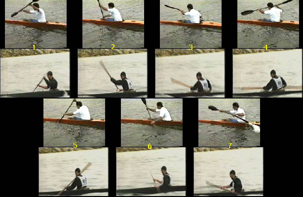
While bracing with the legs, offer Niko a hand up. Notice how much bracing is happening.

And he's up! Now go for a paddle. When the black flies build up, you can use the traditional greenland fly swatting stroke (for another article), or if they are very bad, send him for a 10 minute swim as you paddle. The flies might go away if you are lucky.

Aug 30, 2007

Understanding fast optimal forward stroke - Part 2

The Part 1 was sent around for comments. Here is what I got;

Marcus Demuth recently circled Ireland among other kayak exploits. He is known for long journeys. He uses Werner paddle.
something I did not see mentioned, which is for me the #1 paddling/forward stroke think to know about an efficient forward stroke is the leg work. Push damn hard with your right leg against the footrest while making a stroke on your right, and same on the left side. In my world, the forward stroke happens to 60% inside the boat, and under the spray skirt (the leg work), and 40% is positioning of blade, body rotation, etc.

Marcus pointed out Eric Stiller's article from Mayor's Cup site.

Eric's points are;

The one thing I have done primarily right is to establish a fully body (foot to fingertip), torso rotating forward stroke. A stroke that continually evolves but is about 90% now. While I was aware of leg drive and torso rotation for about 20 + years, I was very happy to find the book "The Baron Mold” written by his coach and filled with excellent information and decent photos. I highly recommend you get a copy of it and EPIC kayaks DVD called "The Forward Stroke".

I have described high level sprint or marathon kayaking as hitting a T-shot with every stroke whereas the face of the paddle has a particular angle , connecting to the water at a particular speed , with a smooth delivery and follow through that is nearly as precise as hitting a golf ball with the face of driving club when done optimally.

Greg Barton has one of, if not the most efficient stroke among Olympic paddlers in paddling history. Once you establish this "high" gear you will be able to apply the basic mechanics to many different paddle angles for different distances, speeds, and conditions (like changing gears on a bicycle but the crankshaft stays the same.

Technique is 70% of the paddling performance equation and all the strength, stamina, endurance, flexibility, speed, and power training only fills in the 30%. (Good Equipment fit is given in this equation). A person with exceptional technique and moderate "fitness" will generally out perform and person with mediocre technique and high fitness.

Race speed, its cadence and the higher blade pressures put very specific demands on the body’s architecture. My torso could turn forever but the Triceps could keep up, hence a 5-10% loss of boat speed for the last 12 miles.

I had compounded this discrepancy by taking out my 212cm Epic Wing Sprint Blade for the event and joked to Greg Barton and Joe Glickman as they passed me (could I trade you for a "mid wing") a paddle with a smaller blade face. The added pressure per blade connection was not conducive to a race of this distance.

Bonnie of Frogma mentioned her blog entry "Of Paddles and Planes"

In this funny article, she loses you in airplane analogy but has some pithy points;
and if this whole aeronautical side trip is weirding you out, don't worry, my next post will be (er, at least if I don't get distracted) about my first lesson (taught by Turner Wilson) on how to actually PADDLE with a Greenland paddle!

a really good intro to the wing paddle, with excellent diagrams, by Olympic gold medalist Greg Barton, can be found here - found it while looking for images


Joe Glickman says in his article;

  • Your hands are an extension of your body," says Oscar Chalupsky. "If your body is stiff your balance is compromised. The key is to relax your body; move with the water, not against it. When in Hawaii, make like a hula dancer and roll your hips with the bumps."
  • Says Gardiner: "Experience is the best teacher of all. When the wind is blowing, force yourself to go out and get used to chop. Make sure you go with a partner, tether your paddle to your boat and paddle along the coast in case you flip.
  • "At the end of the day," says Chalupsky, "your technique will see you through the difficult conditions. The rougher the sea, the more you must concentrate on your style. Make sure you sit up straight. While you still want to concentrate on proper shoulder rotation, dropping your hands will lower your center of gravity and improve your balance. In addition, make sure you use to legs to keep yourself firmly in the kayak and to transfer your power into the boat. The key is to not let your speed drop off. The slower you go the less stable you are."
  • "Too many beginners," says Gardiner, "try and surf across a wave. The key is to take off perpendicular to a wave and drop straight down the face. Once you have the speed you can track across the wave and look for another run. Always try and keep your bow pointed down. To do that, scan the sea for holes in front of you and paddle towards them."
  • "There's a tendency," says Chalupsky, to go way off course when you're chasing the runs. Beware at all times of your final destination. This doesn't mean you have to track a straight line. You don't. But you need to keep your speed up and turn towards your destination while you're using the speed of the wave. That sounds simple but it's easy to lose sight of where you're going."

Greg Barton says in his article about wing paddle;
A wing paddle must be moving sideways, away from the boat in order to function properly. This is the main difference between a wing paddle stroke and a traditional stroke. With a traditional stroke (dashed line below), the paddle is pulled relatively straight back during the stroke. With a wing paddle (solid line) the stroke begins with the paddle next to the side of the kayak, but then the paddle moves steadily away from the boat during the stroke. The stroke generally finishes 12"-18" further away from the boat than it started.
Because the wing paddle is an open wing section (concave on the bottom side), water pressure builds up on the 'lip' at the leading edge of the blade and helps to push the paddle away from the kayak during the stroke. Therefore a wing paddle naturally wants to take the correct path in the water. It is best to pull straight on the paddle without forcing it into or away from the boat, letting the paddle move out on its' own. It will take a while to get used to the feel of the paddle and stroke; but once you find it, the stroke will feel very stable and comfortable. When switching back to a standard paddle, most wing users encounter a lot of flutter, as the traditional paddles do not track nearly as solidly as a wing blade in the water.


The paddle moves outward during the stroke and then exits out to the side. To begin your push for the stroke on the opposite side, do not move your hand close to your head (this would require bending your arm significantly). Instead, start your top hand push wide (away from the body where your previous stroke ended), and slowly come across with your top hand as you push forward. Towards the end of the stroke, your top hand will cross the center of the boat. This is desirable - as your blade and bottom hand move away from the kayak, your top hand should cross over this same amount. The angle of the paddle shaft when viewed from the front should remain nearly constant during the power phase of the stroke.

Water Quality Monitoring -

Without going into detail, quick question for club members. One of the guys at New York Outrigger works for an environmental engineering firm that is developing a water quality testing program involving a network of volunteers. NYO is being something of a beta tester/aquatic guinea pig for the program but once they've smoothed out the process they'll probably be looking to broaden their base of monitors. Focus of the project would be monitoring the level of floatables.

I'll bring this up more formally once I had more details on the project (probably sometime after Labor Day) but in general, does this sound like something in which people might be interested in participating? I assume the testing/monitoring is something that wouldn't fall too heavily on any one individual, for a volunteer-based thing like this to work, the duties can't be too onerous.

Understanding fast optimal forward stroke - Part 1

This series of articles is related to the forward stroke clinic by Joe Glickman. This is to help kayakers better understand elements and variables contributing to forward stroke.

Looking at masters, it is hard to learn because they seem flawless. Dissecting their behaviors and movements and comparing notes would be just as good as learning from master.

I see lots of different movements in efficient stroke;
hip twist
leg push and pull
stomach crunch
straight arms (This is a lot like rock climbing)
gentle introduction of paddle into water
meeting the water sweet spot
rotation of body to crank big muscles into gear
cadence
development of speed
speedy exit of paddle
relaxed and paced stroke for endurance

There are many variables;

type of paddle; wing, euro, greenland
type of hull; hard, soft, and shape

Unlike flatwater paddling, paddling with waves takes mindfullness; this is where my yoga comes in handy. :-)

Go and be one with water and waves..

The catch is that there are many variables. By the time, we have clinic and you can contribute better understanding of how these variables play. So study and practice your strokes. Ask away at the clinic.

For those who are armchair kayaking, here is a reading material written by our guruji, Joe Glickman. I read pages and it is a great fun book. I know I am putting Joe on pedestal. Enjoy it.

The Kayak Companionhttp://www.amazon.com/Kayak-Companion-Joe-Glickman/dp/158017485X/ref=sr_1_2/105-0593803-1050000?ie=UTF8&s=books&qid=1188482619&sr=1-2
Meanwhile, see these videos and more reading materials;
http://www.qajaqusa.org/Movies/movies.html
http://en.kayakwiki.org/index.php/Forward_stroke

http://www.kayakforum.com/Albums/Front_Comparison.jpg

This picture compares wing paddle and greenland. You see surf ski switching and extending legs transmitting power from leg over to shoulder. Green lander enters his paddle closer and takes shorter stroke. He does little stomach crunches and shoves the boat.

http://www.kayakforum.com/Albums/Stroke_Comparison.jpg

This picture shows side view.

Here are some excerpts;

"Below is a comparison of a wing paddle forward stroke and the Greenland forward stroke. These are not completely comparable strokes as the Greenland paddle is doing a long distance race, and the wing paddle is sprinting.

http://www.kayakforum.com/Albums/Front_Comparison.jpg

The most noticable difference is the wing paddler slices his paddle out to the side in the water (Flared Stroke) where the Greenland paddler appears to pull more straight back. The Greenland paddle pushes the upper hand down across the boat, where the wing paddler pushes the upper hand horizontally across at eye level. In both cases the stroke starts out with the upper hand at nearly eye level.

http://www.kayakforum.com/Albums/Stroke_Comparison.jpg

Here you can see that both paddlers use significant torso rotation. It is quite noticable that the wing paddle crosses over the boat with his hands held high, and the Greenland paddler crosses over with hands held low.

Some of these differences may be attributed to the different kind of paddling they are doing. As you increase your stroke rate it helps to have a more vertical stroke. I have found that having the upper hand cross the centre line of the kayak at the beginning of the stroke keeps the blade in a more vertical position and forces good torso rotation. This is virtually the only cause of paddle movement, arm movement being restricted to giuding the paddle out from the boat (or rather allowing the paddle to find its own optimum direction through the water). For longer distance paddling, it is helpful to have a more horizontal stroke. Varying between sometimes more vertical and sometimes more horizontal allows better muscle recovery for longer distance trips. Also note the differences in paddle size and shape. This influences the path the paddle takes through the water and which position is most efficient."

Philippe Castagner sent an interesting article which was forwarded to me about greenland paddle. There are multiple sources of this paddling techniques not just from Maligiaq. It goes to tell you wing paddle might be inspired by greenland. For long distance paddling (> 20 miles), one could develop a different type of paddle.


http://www.qajaqusa.org/Technique/Greenland_technique_from_the_source.html

In this instance, greenland paddle acts like wing paddle; bit of bracing and getting ready for the sweet spot.

Power Phase. Maligiaq does not display as much side-to-side torso rotation as compared to an experienced paddler using the recreational stroke. Instead his pushing hand starts from just below the tip of his shoulder and is levered downward toward the deck, crossing just over the centerline of the kayak. His spine rises slightly and drops down in concert with his arm motion. His elbows stay fairly close to his sides. Viewed from the back, he looks like a boxer making slow motion, downward punches on alternating sides of his foredeck. Maligiaq's paddle shaft was held at approximately a 45-degree angle for normal cruising, higher than the paddles of the surrounding students and instructors (Note - this is the angle between the paddle shaft and the horizon, please don't confuse this shaft angle with the forward tilt of the blade discussed earlier).

The Basin as seen from a satellite.....(click on it to enlarge it)


Aug 28, 2007

Watch the Birdies!

Roz Savage is attempting to cross the Pacific Ocean, Rowing...


Here is a video of her before being rescued by the Coast Guard...for more, click here


Following her successful crossing of the Atlantic in 2006, Roz Savage is bidding to be the first woman ever to row solo across the Pacific Ocean. Her 3-stage row launches from San Francisco in Summer 2007.

This short video shows excerpts of the action from last Thursday afternoon that led up to the helicopter airlift by the US Coast Guard. What it doesn't show is the minutes Roz spent crying after she eventually succumbed to the repeated offers of assistance.

Aug 26, 2007

LI loses money due to beach closures from runoff

Toxic stormwater has helped wash away millions of dollars in beach revenue on Long Island in the first two months of the summer, Sen. Charles Schumer said yesterday.

Speaking with an empty Bar Beach behind him, Schumer said a study by Martin Cantor of Dowling College shows that municipal and state beach closures through Aug. 3 cost Long Island's tourism industry $60 million. The North Hempstead town beach was closed to bathing because of yesterday's storm, but beachgoers still could lay on the sand.

"Our beaches are under attack by stormwater runoff," the Democratic senator said.read more

Aug 24, 2007

Full Moon and paddles

August 25, 2007

We are having the 2nd full moon paddle. It starts around 7 PM with a pot luck. Last time was great.

August 26, 2007

Several members are making a trip to the Breezy Point in the morning. Contact Steve McAllister. We will head out early.

Aug 22, 2007

Urban Legend

We got an email today about a celestial event with Mars appearing as a second moon. I thought it was pretty neat, coming just after our full moon paddle, and before the full moon. But then I found out it was just another "urban legend." Ok, not quite sure why it's "urban" but whatever. Let's just all look up at the sky on the 27th, in case this is a true urban legend. http://urbanlegends.about.com/library/bl_mars_encounter.htm (was "tinkerbell" also an urban legend?)

Aug 20, 2007

Little Place called Jamaica Bay

Most of the time, the bay is where I kayak and play. I escape the city for solitude. Over time, I have noticed little things like birds and fish. Odd little creatures they are. You get a feeling that you do share space with them by observing their habits. Here is Kemp's ridley sea turtle used to be in the bay.

So, I sat down and learn a bit more about what they are; birds and fish. I am not an expert in this. I came across this US government training material from the National Conservation Center. And here is some pictures of birds commonly found in the bay. I linked many of these species to various pictures and sources notably wiki pages.

"The waters and sediments of Jamaica Bay are a highly productive and regionally significant habitat for finfish, shellfish, and wildlife. Eighty-one species of fish were found to use Jamaica Bay in a survey conducted by the National Park Service in 1985, corroborating other findings. The majority of fish collected were juveniles using the bay as a nursery area. Winter flounder (Pleuronectes americanus) was the most important commercial and recreational fish to use the bay in great numbers during all life stages; the bay is also believed to be a significant breeding area for this species. Forage fish species with high abundances, including Atlantic silverside (Menidia menidia), bay anchovy (Anchoa mitchilli), mummichog (Fundulus heteroclitus), Atlantic menhaden (Brevoortia tyrannus), and striped killifish (Fundulus majalis), form a prey base for other fish and birds that use the area. Some of the other common species found in surveys and recreational landings include scup (Stenotomus chrysops), bluefish (Pomatomus saltatrix), windowpane (Scophthalmus aquosus), tautog (Tautoga onitis), weakfish (Cynoscion regalis), black sea bass (Centropristis striata), summer flounder (Paralichthys dentatus), American eel (Anguilla rostrata), and searobin (Prionotus spp.). Anadromous species that use the area include blueback herring (Alosa aestivalis), Atlantic sturgeon (Acipenser oxyrhynchus), alewife (Alosa pseudoharengus), American shad (Alosa sapidissima), and striped bass (Morone saxatilis)."

I am a student of biology. I read this list of endangered species in the bay. Here is Roseat Tern as endangered species.

Federally listed endangered
Atlantic (=Kemp's) ridley sea turtle (Lepidochelys kempii)
roseate tern (Sterna dougallii)
peregrine falcon (Falco peregrinus)

Federally listed threatened
loggerhead sea turtle (Caretta caretta)
piping plover (Charadrius melodus)
seabeach amaranth (Amaranthus pumilis)

Federal species of concern(1)
diamondback terrapin (Maclemys t. terrapin)
Roland's sea-blite (Suaeda rolandii) ...........................

In addition, there are pages about the Jamaica Bay's problems from the government. They are well informed and have been documenting them over a long time.

"Jamaica Bay has been substantially altered by extensive dredging, filling, and development in and around the bay. ..... the bay receives substantial pollution from a variety of point and nonpoint sources; these include municipal waste water discharge from three plants (320 million gallons per day), combined sewer overflows, untreated storm water runoff from the roads and developed areas around the bay (including the runways at John F. Kennedy Airport which are contaminated with de-icing chemicals), leaching of contaminants from three large closed landfills (Edgemere, Fountain Avenue, and Pennsylvania Avenue landfills), atmospheric pollution, especially soot and toxic chemicals from transportation, and windblown trash; there is the added potential risk of spills due to substantial water transportation of oil and chemical products in the bay. Nutrient and high oxygen-demanding organic matter inputs result in phytoplankton blooms, low levels of light transmission, and low bottom dissolved oxygen concentrations. Present and historic inputs of toxics, including hydrocarbons (especially polynuclear aromatic hydrocarbons such as napthalene) and heavy metals, have resulted in contaminated sediments ......"

I also came across this DEP Jamaica Bay Proposal online.

"These various habitats support 91 fish species, 325 species of birds and many reptile, amphibian and small mammal species. The Bay is a critical stop for birds along the Eastern Flyway migration route and has become an internationally renowned birding destination. Portions of the Bay, most notably the Jamaica Bay Wildlife Refuge, have been designated as Significant Coastal Fish and Wildlife Habitats by the federal and state governments."

I also came across a document from the Department of Environmental Conservation. What is cool about this paper is that they have satellite pictures of various islands of the bay from 1974 and 1999. This is imaging study using remote sensing techniques. I am not familiar with the techiques but I noticed that red color had dissipated during the time. From my read on wikipedia of satellite imaging, images do not record what eyes can see since they are recorded in spectral analysis including infrared to reveal material and vegetation. On to what is not cool is that they look like the receding glaciers. These pictures give me the same feelings; receding sea.

I was looking at a picture of a threatened species called seabeach Amanrath. It is 1.3 to 2.3 centimeters and threatened. It lives around the bay's beach.

Seabeach amaranth is an annual plant found on the dunes of Atlantic Ocean beaches. The stems are fleshy and pink-red or reddish, with small rounded leaves that are 1.3 to 2.5 centimeters in diameter. "

See these other colorful neighbors of the bay.

Aug 17, 2007

Atlantic/Long Beach Race in September

We are thinking about a race from the Padergaet Basin to Atlantic/Long Beach.... Only human-powered boats less than 22.5 feet.

The length of the boat requirement has been changed twice already; surf skis and outrigger. It is actually cool. Like that massive cross country skis races out there.

Add another 5 miles to Long Beach Proper if everyone is up to it. That means surf ski, outrigger, canoe, kayak as long as you can pull or push. It will be bunch of us having a race nothing like public affair. If you like to invite friends, that is fine. You need to arrange your own trip back.

Time frame is Mid September. The 11th and 26th of September are full moon. The 23rd is autumn equinox and is Sunday. We are looking at between the 10th and 19th.

We are looking at a very long day starting at the sunrise and ending on the Long Beach. The distance is more or less 19.45 miles over the air. We can extend it to the Long Beach proper. That is another 5 miles.


Here is the Google Earth keyhole. http://bbs.keyhole.com/ubb/showflat.php/Cat/0/Number/976581/an/0/page/0#976581

You round off the Breezy point and go straight to the Long Beach.

Send me email if you are interested and I will keep you posted.

Jet Ski Busters Needed

I decided to spend time to photograph jet skis and riders. Most of them come to and from the Mill Basin. Around 5 PM, there seem to be a peak. I plan to take my good camera to the Mill Basin bridge with the radio in Pelican container.

If you see them, note time and description of the ski and people. Send it to me. I have been reading about the 2 stroke engine used in them emitting more than 30 percent of fuel into the water and air. More

"The carbureted two-stroke engine, until very recently the standard powerplant of the PWC industry, together with outboard motors generates over a billion pounds of HC emissions each year. These high emissions are attributable to the two-stroke engine's emission of as much as 30% of its fuel charge -- part of which is oil -- into the water and air. The EPA claims that just 7 hours of use of these older carbureted marine engines releases as much pollutants as a modern car driven 100,000 miles."

I will send printouts to the Coast Guard. So, please become jet ski busters and join a move to drive them all out.

Aug 16, 2007

Her son died in Mill Basin Jet Ski crash, now wants stricter laws

Together with local officials, she is pushing for stepped-up enforcement and stricter laws regulating the high-speed water scooters popular in waterfront neighborhoods around Jamaica Bay, Pelham Bay and other areas. the rest of the article, click here

Another day on Jamaica Bay

Just before the open paddle, I went out on a surf ski. Moving on surf ski is different from kayaking. It makes me focus on forward strokes and I feel every bump and wave.

Today is another day like others. Two people on a water scooter tried to gun me and came within eight feet or so from behind. I was crossing the Mill Basin channel and tend to look both ways for boats. There are quite a few water scooters hanging out. I made it almost to the other side short of a hundred yards or so. They came from the bridge and instead of going straight, they went diagonally towards the metal wall. They saw me and tried to be funny. There was nothing funny about what they did. There were at least four scooters and they seem to know each other. Two people on the scooter were wearing red PFDs. I abhor scooters for their lack of common sense or protocol.

During the open paddle. as we were passing the beach to the marsh, the NY Police boat rushed to the green buoy full speed and then made almost U turn and started using a loud speaker. There we sat and straining to listen what they were saying. They were saying we should not get on the horse beach. What an odd experience?

The paddle went fine except until we were back in the basin. I surged ahead and logging some sweet forward strokes. A boat was passing but he was lagging behind me. I slowed to Phil's request to let the boat go. Crossing the water behind the boat to the right of the basin, there was a large fresh oil slick. It did not smell but it covered a large area. It could have been engine oil. I think he slowed to release oil before going into his marina. I went over and tried to speak to him about his spill. He did not respond and I remembered his plate.

It seems more motor boats are on the water. There must be rush hours on the bay and I like to find about them.

Aug 15, 2007

Boats With Stories to Tell, Rescued From Obscurity

BUFFALO, Aug. 13 — Todd Parmington was finishing a restoration of a guide boat built about 1888 that ferried campers to church services in the Adirondack Mountains when he got an e-mail message in May from a teacher in Vancouver, Wash., researching her family’s genealogy.
for the rest of the story, click here

Aug 13, 2007

Harsh marsh forecast predicted - Experts warn vital Jamaica Bay wetlands are disappearing fast

By Gary Buiso
Jamaica Bay is losing its marshes at a precipitous rate—far greater than previously suspected, a stark reality that could have grave consequences for wildlife seeking In just five years, the bay’s saltwater marsh islands could be rendered a faint memory, according to the study, prepared by the Jamaica Bay Watershed Protection Plan Advisory Committee and the National Park Service’s Gateway National Recreation Area, which includes Jamaica Bay.

“We found the rate of loss appears to be increasing,” said Doug Adamo, Chief of the Division of Natural Resources at Gateway and co-chair of the advisory committee.

The study updates a 2001 State Department of Environmental Conservation analysis that predicted the marsh island’s demise by 2024.

Using 2005 data for key representative marshes, the new study, find a faster pace of deterioration. The new study uses more comprehensive satellite imagery and aerial photography.

“Without a concerted effort to counteract this loss, these marshes, and the benefits they provide to the bay’s wildlife and the regional ecosystem, and to the surrounding communities, can be anticipated to be lost in the near future,” the study warns.

The report found that by 2003, just 37 percent of the tidal wetlands that were present on Jamaica Bay’s marsh islands in 1951 still remain, and that between 2003-2005, four of the five case study marshes lost 54 additional acres—almost 30 percent of the tidal wetlands they had in 2003.

If the observed losses are extrapolated for the entire bay—and there is no intervention to prevent further loss—the bay’s marsh island’s are projected to disappear by 2012.

Adamo said the cause of the loss is still unknown.

But one prime suspect has emerged: human beings.

“The majority of it is caused by nitrogen releases from sewage treatment plants,” Adamo said.

The four sewage plants that deposit cleaned wastewater into the bay contributes mightily to nitrogen pollution—to the tune of 30,000-40,000 pounds of nitrogen a day.

While marsh plants require nitrogen to survive, too much of it can be a good thing.

“Once you reach a critical level, you affect the sulfide level in the roots of the plants,” he continued. Sulfide levels, in turn, reach toxic levels, destroying the plants’ roots, which are essential to keep the marsh substrate intact.

When the roots are dead, a foul, amorphous mass, Adamo called, “black mayonnaise,” is left in their place.

“Once that happens, entire clumps of vegetation floats away,” he said.

The marshes serve as food sources for a shellfish and other invertebrates.

“You are basically destroying the very beginning of the food chain, which is critical for higher organisms to feed on,” Adamo said. Each subsequent organism, will have difficulty finding food.

“You are in trouble all the way up the line,” he said.

Another theory for the deterioration is the continuing decrease in the amount of sediment deposits reaching the marshes. Increased development near the bay, as well as dredging in sections of the bay could be acting as barriers to ocean sediment that needs to travel into the bay and sustain the marshes, according to the committee.

The study recommends “immediate and aggressive efforts to address this emergency.”

The study urges a Jamaica Bay nitrogen control strategy that would reduce current levels of by 55 percent reduction, a recommendation previously made by the advisory committee.

“To keep pace with the problem as much as possible there should be a significantly expanded effort to restore and expand marsh habitat on existing islands, as well as to protect and restore fringe tidal marshes around the bay,” according to the report.

The study also recommends the creation of a task force comprised of federal, state and city officials, to ensure that necessary actions be taken to address the marsh loss crisis.

Moreover, the study notes, the exact cause of the deterioration must be found.

The committee recently submitted its final recommendations for the city Department of Environmental Protection (DEP)’s Jamaica Bay Watershed Protection Plan.

Local Law 71, enacted in 2005, compelled the city’s Department of Environmental Protection (DEP) to craft a plan for the bay. The city’s final plan is due in October 2007; the new study will be taken into account before that plan is issued, the agency has said.

The DEP has reportedly said that the link between nitrogen and the marsh loss is weak, pointing to the fact that nitrogen levels from sewage plants have dropped by a third over the past 10 years.

The bay, a unit of the National Park Service, borders Brooklyn, Queens and Nassau County. It includes 26,645 acres consisting of open water, meadowland, marshes, dunes and forests.

The bay and its uplands are a critical habitat for more than 80 species of fish, as well as a host of endangered and threatened species, including the Peregrine Falcon and Atlantic Ridley sea turtle. Each year, nearly 20 percent of North America’s bird species visit Jamaica Bay.


Official: Scotland's beaches are now more polluted


Rob Edwards Environment Editor

THE pollution of Scotland's beaches by sewage this summer was worse than last year, according to new figures from the Scottish Environment Protection Agency (Sepa).

This contradicts widely-publicised claims by the Scottish Executive last week that bathing waters had "never been cleaner", and prompted accusations that ministers have been "massaging" statistics to obtain good headlines.

Over the last four months, Sepa has analysed more than 1100 samples from Scotland's 63 officially-designated bathing waters. The average level of faecal contamination in these samples provides the most accurate measure of overall sewage pollution. According to Sepa, this year's average faecal coliform count was 172, compared to 166 last year.

The worst polluted beach was Ettrick Bay on the Isle of Bute, which recorded an average faecal coliform count of 734 - more than four times the average for all beaches.

Other badly contaminated beaches were Pencil in Largs, Luss Bay on Loch Lomond, Irvine, and two beaches in Nairn. All of these bathing waters narrowly missed being officially recorded as "failures" this year because only one water sample exceeded the legal sewage limit. It normally requires two samples in excess of the limit to trigger a failure.

In the one case where there were two samples in breach of the limit - at Carnoustie in Angus - Sepa took an unprecedented decision to double the number of samples taken from 20 to 40.

Sepa said this "diluted" the two breaches so that bathing waters could be passed.

These factors allowed the Scottish Executive to assert that all Scotland's beaches had passed the legal limits for the first time. Yesterday, the deputy environment minister, Rhona Brankin, was pictured paddling for photographers. "Scotland's bathing waters have never been cleaner to swim in, " she said.

Green MSP Mark Ruskell said the Executive's claims ignored Sepa's findings. "This appears to be a clear attempt to gain positive headlines despite the facts, " he said.

From natural treasure to cesspool - Grim forecast for the future of Jamaica Bay


By Gary Buiso

Within just a decade, Jamaica Bay could dramatically shift from an important natural habitat into a cesspool, preservationists charged with protecting the water body recently warned.

And the city will be largely responsible for which direction the bay’s health turns.

“Jamaica Bay could be transformed from an incredibly significant salt marsh landscape with hundreds of species of birds, and serving as a nursery for fish—into basically all open water, turning a putrid pea green in the summer,” said Brad Sewell, the co-chair of the Jamaica Bay Watershed Protection Plan Advisory Committee.

“It really will be that kind of time scale,” Sewell said. “We’re not talking about a century. This is only a matter of years.”

During the last decade, the state Department of Environmental Conservation calculated that marshes are lost at a rate of 44 acres per year. “Every indication is that that rate has increased,” Sewell said.

The committee recently submitted its final recommendations for the city Department of Environmental Protection (DEP)’s Jamaica Bay Watershed Protection Plan.

The committee’s major recommendations target the two biggest problem the bay faces: water pollution and habitat degradation.

The bay is the depository of the city’s treated wastewater—approximately 300 million gallons a day. That water has a high concentration of nitrogen, but the bay’s marshes can only remove some of it, resulting in poor water quality. Wastewater and overflow from sewage treatment plants contribute to harmful algae blooms that diminish the bay’s dissolved oxygen, a condition that can kill wildlife.

“We are targeting these huge discharges of nitrogen pollution [treated human waste] coming from our wastewater treatment plants” and emptying into the bay, Sewell said. “We’re asking for a significant reduction in that.”

“The advisory committee recognizes it’s a huge problem and the city should step up and do what the bay needs—and what its legally required to do,” he added.

The committee also recommends that the city, in the long term, look to reconstruct its infrastructure so that every time it rains, the over flow from the sewers don’t empty into the bay.

As far as the habitat, the city must stop auctioning off wetlands to “the highest bidder,” Sewell said. A habitat protection and restoration program must target the bay’s peripheral tidal wetlands and upland buffer areas—including their immediate protection from development, the committee urged.

At the current rate of loss, the marsh islands will completely vanish by 2024, according to the committee’s report. It is unclear why the marshes are in jeopardy, but some studies suggest the reduction of sediment washing up on the marshes and excessive sulfides in sediments due to water pollution could play a role, the committee has reported.

In all, there are five priority recommendations. The other three include improving stormwater management; an expansion of efforts to restore the bay’s interior salt marshes; and a comprehensive science program for the bay.

The DEP submitted a draft of the Jamaica Bay Watershed Protection Plan in March. Critics of the plan said it did not contain a proposed set of actions, but rather a set of proposed actions still under consideration. Local Law 71, enacted in 2005, compelled the DEP to develop a watershed protection plan for the bay, and to establish the committee to advise the DEP and the City Council.

A final plan is due in October 2007.

Sewell said he remains guardedly optimistic the city will do right by Jamaica Bay. “It’s not too late for them to make the right decisions. To date, we’re not optimistic about the big decisions being made in the right way…but we remain hopeful.”

The bay, a unit of the National Park Service, borders Brooklyn, Queens and Nassau County, and includes 26,645 acres consisting of open water, meadowland, marshes, dunes and forests.

More than 80 species of fish, as well as a host of endangered and threatened species. Each year, nearly 20 percent of North America’s bird species visit Jamaica Bay.

Aug 12, 2007

25 Seconds Yank Rescue

This video demonstrates how to reduce rescue by half compared to 45 seconds average T rescue.


Video

California's beaches continue on bum record

It is not just bad in Brooklyn.....


Beach closures and advisories in Los Angeles County last year fell a nose short of the record high set in 2005, according to a report issued Tuesday.

Across California there were more than 4,600 incidents of closed beaches or posted advisories in 2006, according to the review by the Natural Resources Defense Council. Of those, 2,072 were in Los Angeles County.For more, click here

Aug 11, 2007

Casuality of Eskimo Roll


See what happens when your eagerness gets better of you. Rolling casuality.

Hans is someone with Class V coaching certified or highly accomplished from flat land called Netherland. He did not check the water depth before rolling into water. More

NYC Dept of Health Randomly Changes Figures

The Dept of Health tests the water quality at various beaches, and often makes major errors. Here is an example of the kind of error they will make:

At Gerritsen Beach, they will get a very high bacteria count, post it, and warn people not to swim. Then they will remove it and lower it back to normal. For more information, click here

Aug 10, 2007

NPR radio's Brian Leher Show

Listen to Broadcast and see Club members comments..

Runoff Worries

Wednesday’s heavy rainfall calls attention to NYC’s sewer system and the problem of stormwater runoff. Jarrett Murphy, investigations editor at City Limits, and Basil Seggos, chief investigator at Riverkeeper, discuss the issue and the options the city is exploring.

click below to hear the radio show:


Posted by: Philippe Castagner August 10, 2007 - 10:21AM
Brooklyn

No doubt we will be hearing about how rain can overwhelm the system. I paddle and often fush on Jamaica Bay in a kayak several times a week, and sometimes I fish all night. I have personally observed Paerdegat Basin change from relatively normal looking to a cloudy blue-green-white, oily, stinky, sinister looking consistency overnight this spring. This happened on a day with no rain, and it happened sometime after I launched and before dawn, when I returned. These conditions have often been accompanied by floating fecal matter, used feminine hygiene products, latex condoms, and the like.

The issue is not just overflow from rain. It is a habitual use of public waterways as a toilet.

Aug 9, 2007

Quote from Thursdays New York Times


Most of New York City’s 6,000 miles of sewage lines are dual use; they handle rain runoff as well as sewage and industrial wastewater in the same pipes, before delivering the mixture to the city’s 14 wastewater treatment plants. Heavy rains perennially overwhelm the pipes, causing the flow to back up, dumping everything from fecal matter and household trash to industrial pollutants like oil, grease and heavy metals into the city’s waterways and streets.

About 40 billion gallons of rain and sewage water per year to overflow onto city streets and into waterways, leading not just to transportation headaches but also to serious health and environmental hazards as the overflow spills raw sewage, trash and pollutants. The overflow also pollutes the waterways around the oceanfront and is blamed for the poor water quality around the city’s beaches. For the rest of the article, click here

No damage around the club


I did not see any or damage. No tree uprooted nor branches. It was bad
in Bay Ridge, Kensington, parts of Ditmas. It must have tracked
across Brooklyn. All the wood chips by the gate are arranged like a Zen garden probably because there was a large pool of water. The garden looked fine and dandy.

The night before around Brooklyn College, I noticed fog thick enough that you can discern light and dark parts of the fog as if you are in a cloud. I checked the weather and it mentioned lightning and storm warnings throughout the day with a spell of the Sun midday. The fog was special as if it hung in the air and around the street light, you can see gradients of fog.

At 6:30 AM, I waited out lightning storm and torrential rain (It reminds
me of India and Thailand) and sat 50 minutes in Q train before aborting
to go to Staten Island to help John Santana sail to the Mystic
Harbor. At Church Ave, one of large trees toppled and stopped all traffic to Manhattan. Lightning was intense and numerous. It was like lightning storms out west when metal starts singing.

There were incredible amount and number of debris in the water and Pete was mortified after getting from open paddle. He was describing a dead rat sizing a foot.

I just did not feel going out yesterday and enjoyed the brilliant sunset
instead. The sky was so clean and hardly any wind higher up although
there was a good steady breeze on the ground.

I hope everyone fared well.????

Aug 8, 2007

Water for Thoughts

This is an editorial piece on the water quality of the basin and the bay in general.

We have experienced the water quality issues around us. Here is a recent news article about a Chicogo beach, Jackson Park Beach.

"Here and across the country, water tests on a fraction of the nation's ocean, bay and Great Lakes beaches led to a 28 percent jump in beach closings and warnings nationwide, the study showed. In Illinois, the state counted 591 beach closing days or swimming advisory days during 2006, up from a year earlier when there were 584."

It sounds like we are the same boat with "the planning of sewage and storm water treatment." We also had many weather pattern changes.

"Aging and poorly designed sewage and storm water systems hold much of the blame for beach water pollution," the group said in a statement. "The problem was compounded by record rainfall, which added to the strain on already overloaded infrastructure."

The report they are refering to is prepared by the Natural Resources Defense Council.
For the full report, click here. Specifics of New York state are found in this PDF document.


"In 2006, the Tier 1 beaches with the highest percent exceedances were Point Gratiot Beach in Chautauqua County (47%), Boys And Girls Harbor in Suffolk County (40%), Tides Property Owners Association in Suffolk County (40%), Main Street Beach (35%) and Wright Park East in Chautauqua County (35%), Ontario Beach in Monroe County (31%), Wright Park West in Chautauqua County (29%), Pultneyville Mariners Beach in Wayne County (29%), and Valley Grove Beach in Suffolk County (28%). "

So, it seems we are doing better than others. This is a general trend across the country. Related articles are found in LA Times, Fox News, Chicago Tribune, Reuter, Washington Post, and some 123 sources. These articles are related to the report by the Cultural Resources Defense Council.

Surfers against Sewage is a UK based outreach group with awareness and education programs.

There is also a local group, ALSNYC.

"You can also contact www.alsnyc.org, the American Littoral Society in Broad Channel headed by Don Riepe. These people are the true stewards of our bay and I suggest we can team up with them. We can and should go as individuals who happen to kayak in these waters to the meetings that are already organized by the Jamaica Bay people. They often have the elected officials coming also." by Yvonne

"The Neighborhood Open Space Coalition has a full roster of advocacy groups and list serves that focus attention on these issues. See the side bars at http://www.treebranch.com. I didn't find the Jamaica Bay list serve there yet, but this seems like a good reference to list. " by John Wright, the Commodore.

In general, there are many blames to go around as well as "who knew". More people know about it, the better it is. More people come out to the club and enjoy the bay, the better they understand what we will all be missing.

Given we experienced changes and rise of "dirty water", we are in the same boat.

Aug 6, 2007

SEA KAYAK BEATS SURFSKIS AT THE BLACKBURN


Greg Barton
2:32:58
Don Kiesling
2:34:42
Joe Glickman
2:37:26
Erik Borgnes
2:37:57
Brian Heath
2:41:11
Ken Cooper
2:47:36
Mike Tracy
2:51:15
Mike McNulty
2:51:18
Tim Burke
2:51:22
Kurt Kuehnel
2:54:55

For the rest of the article, By Joe Glickman, click here


Aug 5, 2007

Birding by Boat

The Jamaica Bay Birdwatching Paddle on Saturday morning was highly successful. Six of us took a very leisurely paddle to check out the shore and water birds. One of our discoveries, launching a few hours after low tide, was a great variety of birds in our own basin. Louis suggested heading up the basin to check out the new salt marsh remediation area, and in our brief paddle past the marina we found many species, including Yellow-crowned Night Heron, Short-billed Dowitcher, Killdeer and Semi-palmated Plover.

We saw the four common gulls that inhabit our waters in the summer, and also the two terns (though fewer of those than usual). After exploring the basin we headed into Jamaica Bay and over to Canarsie Pol. With the tide about half way up we could paddle into the marshes, but there was still plenty of mudflat exposed for feeding birds.

Among the large wading birds in the area we saw Great Egrets, Snowy Egrets, Great Blue Herons and Glossy Ibis. One spot along the back of the Pol featured trees filled with egrets and a few herons. It was fun to see them rise up in flight suddenly from the marsh grass. Jamaica Bay is a highly rich birding destination, visited by birdwatchers from all around the country.

Recently there have been some rare bird sightings in the wildlife refuge that have attracted crowds to those mudflats, even in the sticky heat of the past few weeks. Let's hope this resource continues to be available, and that our marshes are not obliterated by the pollution of the bay.

Aug 3, 2007

NYC Dept of Health issues an Advisory in Error...

Click here for more info
The City Dept of health issued an advisory IN ERROR and then pulled it off the website..
It originally read:

advisory....bacteria levels were over 255 per 100 ml (which is way over the limit)

now they removed the advisory and deleted the results for August 4th..which is
post dating a water test....go figure....

Aug 2, 2007

Jamaica Bay Loses Marshes at Faster Rate, Report Says


American oystercatchers taking flight in the marsh grasses of Jamaica Bay, where marshland is shrinking. They are on the Audubon Society’s watchlist for species facing population loss or threats like loss of habitat.


EW YORK (AP) - The scene from Dan Mundy's living room window is worlds away from the normal urban views of New York City.

The sky is a brilliant blue, and the waters lapping at the stone wall just a few feet away are clear and calm. A duck paddles off, and even a jellyfish looks more peaceful than dangerous as it undulates near Mundy's dock.

Welcome to Jamaica Bay, a wildlife haven just next door to John F. Kennedy International Airport, reachable by subway from Manhattan's skyscrapers some 15 miles away.

The tranquility hides a truth well-known to Mundy and others who have spent their lives here - the salt marsh islands dotting Jamaica Bay are disappearing.

The loss of the islands could have huge ramifications for the environment because a quarter of the country's bird population makes its way through Jamaica Bay.

Marsh loss has always been part of life in the bay, but it has been accelerating in the past decade or so, said Mundy, a retired firefighter who advocates for the marshes.

Records show Jamaica Bay averaged a loss of 26 acres a year from the mid-1970s until the mid-1990s, but the pace picked up to more than 40 acres a year by 1999, the last time a comprehensive look was taken, said Brad Sewell of the Natural Resources Defense Council, who serves as co-chairman of an advisory committee for the bay.

Anecdotal evidence indicates the situation has probably gotten worse in the last couple of years.

There are around 1,000 acres of salt marsh islands in the bay. If the disappearance continues at its current rate or accelerates, the islands could be gone in less than 20 years, Sewell said.

No one knows for sure why the marshes are disappearing. Several possibilities are being considered, including the rise in sea level and the lack of sediment to renew the marshes flowing into the bay.

``Research has looked at a handful of contributing factors, none of them have emerged as a clear cause,'' said Steve Zahn, a program manager for a marine resources unit for the state Department of Environmental Conservation.

Some are convinced that excessive nitrogen from the city's four wastewater treatment plants is a factor. The nitrogen - a byproduct from the water treatment process - feeds algae blooms, which die off and are decomposed by bacteria that use a lot of oxygen, leaving less in the system.

The city acknowledges that more nitrogen than the system can handle is being discharged into the bay, but also says there is no definitive scientific evidence that the nitrogen is the main cause of the marsh loss.

The scientific model for water quality doesn't show that making the significant financial investment into reducing the amount of nitrogen coming out of the wastewater treatment plants will significantly raise the dissolved oxygen level, said Angela Licata, deputy commissioner of environmental planning and analysis at the city Department of Environmental Protection.

The water quality model did show an improvement in Long Island Sound, so the city invested in reducing nitrogen output there, she said.

Restoration is one possible way to fix the problem, but restoration projects are expensive.

A couple of marsh islands have been replanted, but the cost needs to come down before more projects are done, said Douglas Adamo, chief of the division of natural resources for Gateway National Recreation Area, of which Jamaica Bay is a part.

Otherwise, ``the cost will be so prohibitive that we're not going to get many acres for the dollar,'' he said.

But the price of a bay without the marsh islands is higher than anyone would want to pay, said Mundy and others.

Mundy pointed out that the islands act as a buffer for waves coming across the bay. Without them, the waves would roll in several feet higher than they already do. ``It's like a disaster waiting to happen here,'' he said.

And the role the marshes play in the ecosystem can't be overstated, with so many fish and fowl in the bay, Sewell said.

Plus, he said, it's a resource for urban dwellers. ``It's the only unit of the National Park Service that's accessible by subway,'' he said.


Angela Licata, Deputy Commissioner, NYCDEP sums it up here:
(at a meeting last year)
"Now, I see problems with the bay and you know the problems with the bay. DEP is throwing 320 million gallons of polychlorinated water into Jamaica Bay every day, 54,000 pounds of nutrients every day. That's detrimental to the bay. Can we correct that? Yes, we can correct it. They did it in Seaford. They put a pipeline to the ocean, I've been spouting this over and over, and this is not new to you, John. It may be new to some people here, but after they did that in Seaford, they opened up clamming again and it's not hurting the ocean because most of that water is treated and they could handle 54,000 pounds of nutrients, and they can handle chlorinated water. Jamaica Bay is having trouble handling it. Do you want to know why the marshes are disappearing? That's a good reason. We can spend one million dollars and put marshes back there but it's not going to cure the problem. The problem is being –- we’re killing the stuff instead of growing the stuff. There's other problems in the bay too that -- the airport, there's floatables that still come from Bergen Basin. After the storm they open up the sewers. I see it, I live on the water and when I see that water change, I know what’s floating in that water. When it's floating in the water, that means they opened up the sewers. I know what I'm talking about, the sanitary napkins, the condoms, stuff like that. That's not in our water. That's from our sewers and that comes every time you get a hard rain and the bay can’t handle it and it's full."